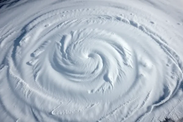
Nor’easters Getting a Hurricane Makeover
This weekend’s intense coastal storm battering the Eastern Seaboard is drawing comparisons to a hurricane, a phenomenon typically associated with warmer tropical waters. While it’s crucial to remember this is a winter phenomenon, the Nor’easter’s ferocity and structure are indeed exhibiting traits that make it seem remarkably hurricane-like. This isn’t just a stronger-than-usual winter storm; it’s a complex meteorological event that highlights our evolving understanding of weather patterns and the increasing intensity of extreme weather. The storm forecast models have been intensely focused on this system, and its unusual characteristics are a testament to the dynamic nature of atmospheric science.
What’s Making This Nor’easter Act Like a Hurricane
At its core, this Nor’easter is drawing power from a clash of air masses, a common driver for intense winter storms. However, several factors are amplifying its strength and structure in ways that resemble tropical systems. Unlike a typical Nor’easter, which often relies on the temperature gradient between cold continental air and warmer ocean air, this storm is tapping into an unusually warm patch of the Atlantic Ocean. This warmth provides the storm with a significant fuel source, much like a hurricane draws energy from warm ocean waters.
Think of it like a high-performance engine. A regular engine gets adequate fuel, but this storm has access to super-premium fuel. This allows it to develop a more defined, compact circulation, similar to the “eye” and eyewall structure seen in hurricanes. While this Nor’easter won’t have a true eye, its circulation is becoming remarkably organized. Furthermore, the jet stream, a fast-flowing current of air high in the atmosphere that dictates weather patterns, is also playing a crucial role. It’s providing an intense downward pull on the storm, helping to organize its structure and enhance its wind speeds. This combination of warm ocean waters and a favorable jet stream pattern creates a perfect storm scenario, pushing this coastal storm into a more hurricane-like intensity.
Where We See These Storm Similarities Today
The similarities to a hurricane are primarily observed in the storm’s structure and its wind field. Meteorologists are noting the development of a more concentrated area of intense winds near the storm’s center, a hallmark of tropical cyclones. The intensity of the rainfall and potential for storm surge, especially along coastal areas, are also elevated, mirroring the impacts of a hurricane. While tropical systems derive their energy from latent heat released by condensation of water vapor over warm oceans, this Nor’easter is leveraging a similar principle with a different energy source – enhanced baroclinic instability fueled by strong temperature contrasts and abundant moisture.
The storm forecast for this event has been meticulously tracking these developing characteristics. For instance, the National Hurricane Center, while not issuing hurricane advisories for this winter storm, has been monitoring its development due to the significant impacts it is expected to bring. Residents in affected areas are experiencing the kind of severe weather warnings and potential for widespread disruption that are more commonly associated with a hurricane landfall. This includes warnings for damaging winds, heavy precipitation, and significant coastal flooding.
The Weather Forecasting Tools at Play
Accurately predicting a Nor’easter with hurricane-like characteristics relies heavily on advanced meteorological technology and sophisticated computer models. These models, such as the Global Forecast System (GFS) and the European Centre for Medium-Range Weather Forecasts (ECMWF), ingest vast amounts of data from satellites, weather balloons, buoys, and ground-based sensors. They then use complex mathematical equations to simulate the atmosphere’s behavior over time.
Think of these models as incredibly powerful simulation engines. They take the current state of the atmosphere and predict how it will evolve. For events like this Nor’easter, the models are crucial for understanding the interplay of factors: how much warmth is available from the ocean, the precise position and strength of the jet stream, and the movement of low-pressure systems. Researchers at institutions like the National Oceanic and Atmospheric Administration (NOAA) continually work to refine these models. For example, recent advancements in computational power and data assimilation techniques allow for higher resolution forecasts, meaning they can depict smaller-scale features and more accurately capture the dynamics of intense storms. The ability to predict the rapid intensification of such systems is a key area of ongoing development in atmospheric science.
Why This Kind of Storm is Becoming More Common
The increasing frequency and intensity of extreme weather events, including powerful Nor’easters with hurricane-like characteristics, are a growing concern. While attributing any single event to climate change is complex, the overall trend points towards a warmer planet providing more energy for storms. Warmer oceans, for example, can fuel more intense tropical systems and can also contribute to more robust winter storms by providing a larger source of moisture and heat.
Furthermore, shifts in weather patterns, potentially linked to climate change, can create more favorable conditions for these types of storms to develop and strengthen. This includes changes in the behavior of the jet stream, which can become wavier or more persistent, leading to prolonged periods of intense weather. The Intergovernmental Panel on Climate Change (IPCC) has highlighted in its recent reports that the intensity and frequency of extreme weather events are projected to increase in a warming world. This Nor’easter serves as a stark, real-world example of these projected changes, underscoring the significance of understanding these evolving weather patterns.
The Challenges of Predicting These Evolving Storms
Despite advancements in atmospheric science and forecasting technology, predicting the exact behavior of intense coastal storms like this Nor’easter remains a challenge. One of the primary difficulties lies in the rapid and complex interactions between different atmospheric phenomena. While models are becoming more sophisticated, they still have limitations in perfectly capturing the fine-scale dynamics that can lead to rapid storm intensification.
For example, accurately forecasting the precise track and intensity of a Nor’easter that is feeding off both cold air from land and warm air from the ocean can be more challenging than predicting a straightforward hurricane. The transition zone between these air masses is dynamic, and small errors in the initial data fed into the models can lead to significant differences in the forecast outcome. Furthermore, the increasing rarity of certain storm configurations means that forecasters have less historical data to draw upon for direct comparisons, making it harder to refine predictions. This means that while we can anticipate a powerful storm, pinpointing its exact impact zone and peak intensity can still be a moving target.
What the Future Holds for Winter Storms
Looking ahead, the trend of more powerful and potentially hurricane-like winter storms is likely to continue. As global temperatures rise, the oceans will remain warmer, providing a continuous energy source for storms. We can expect to see more instances where Nor’easters exhibit enhanced wind speeds, greater organization, and a more significant storm surge. This means that communities along the coast will need to prepare for more frequent and intense extreme weather events.
The ongoing research in atmospheric science will focus on improving our ability to predict these rapid intensification events. This includes developing higher-resolution models, enhancing data collection from remote ocean areas, and better understanding the complex feedback loops between the ocean and the atmosphere. The goal is to provide more accurate and timely warnings, allowing for better preparation and mitigation efforts against these powerful coastal storms.
Key Questions and Answers about This Nor’easter
Is this Nor’easter actually a hurricane?
No, this is a Nor’easter, a winter phenomenon driven by different atmospheric processes than tropical systems. While it is exhibiting hurricane-like characteristics in terms of intensity and structure, its origin and energy source are distinct from a true hurricane.
Why are winter storms becoming more powerful?
Warming global temperatures, particularly warmer ocean waters, provide more energy and moisture for storms. Additionally, changes in weather patterns, including the jet stream, can create conditions more conducive to intense coastal storms.
How accurate are the storm forecasts for these events?
Current storm forecast models are quite advanced and can accurately predict the general track and intensity of such powerful storms. However, predicting the precise moment of rapid intensification and localized impacts can still be challenging.
What are the main risks associated with a Nor’easter like this?
The primary risks include damaging winds, heavy snowfall or rainfall, widespread power outages, significant coastal flooding due to storm surge, and disruption to transportation and infrastructure.
Who benefits from understanding these Nor’easter trends?
Coastal communities, emergency management agencies, meteorologists, infrastructure planners, and anyone living in regions prone to severe weather all benefit from understanding these evolving weather patterns. This knowledge aids in preparedness and resilience planning against extreme weather.
What are the long-term implications of these increasingly powerful winter storms?
The long-term implications include increased costs associated with disaster recovery, potential shifts in population distribution away from vulnerable coastal areas, and a greater need for investment in climate-resilient infrastructure and early warning systems.
This article explores the evolving nature of winter storms and their increasing intensity. While current forecasting models are sophisticated, the field of atmospheric science is continually advancing to better predict and understand extreme weather events.
This article is based on current meteorological understanding and public data. Specific weather phenomena can be complex, and forecasts are subject to change. For the latest information, please consult official weather advisories.