The New Frontier of Volcano Forecasting
For centuries, volcanic eruption prediction has been more of an art than a science. Volcanologists have relied on the visual observations of plumes or the monitoring of earthquake swarms, often catching the signs only days or hours before an event. However, a shift is occurring. By moving from purely descriptive monitoring to a deep understanding of physics, researchers are beginning to treat volcanoes much like meteorologists treat weather systems.
This development is significant because it aims to replace reactive guesswork with proactive, data-driven hazard mitigation. Recent breakthroughs in computational power and sensor sensitivity have allowed scientists to model the internal plumbing of volcanoes with unprecedented accuracy. Research published by institutions like the Carnegie Institution for Science and the University of Bristol suggests that by applying advanced laws of thermodynamics and fluid dynamics to magma flow, we can begin to forecast eruptions with significantly higher lead times. This transition toward physics-based forecasting is no longer a theoretical exercise but a growing field of study designed to save lives and protect infrastructure from geological hazards.
How Physics Transforms Volcano Monitoring
To understand how physics improves eruption forecasting models, imagine a pressure cooker. Traditional monitoring is akin to simply watching the steam coming out of the pot and listening for the whistle. If the whistle blows, you know something is happening, but you do not know how much pressure is left inside or if the pot is about to crack. Physics-based modeling, by contrast, is like placing sensors inside the cooker to measure the temperature, the viscosity of the liquid, and the structural integrity of the steel.
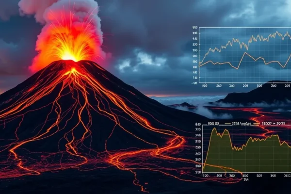
At the core of this approach is geophysics. Scientists analyze seismology, the study of vibrations in the earth, and use it to map the movement of magma. They combine this with studies of magma dynamics, which examine how molten rock flows through cracks and reservoirs. By creating a mathematical digital twin of a volcano, researchers can simulate how magma travels through the crust. When new seismic data flows into these models, they act as a “weather forecast” for the earth, calculating the probability of an eruption based on physical constraints rather than just historical patterns.
Current State and Real World Applications
We are currently in the early adoption phase of these high-fidelity models. Today, agencies like the United States Geological Survey (USGS) and the Global Volcanism Program already integrate real-time seismic monitoring with physical models to track active sites like Kilauea in Hawaii or Mount St. Helens. These systems are moving away from simple threshold alerts—where an alarm sounds if tremors reach a certain level—toward integrated data platforms.
In Europe, projects like the Horizon 2020 initiative have funded research into real-time hazard assessment tools that combine satellite radar imagery with ground-based geophysics. These tools are used to monitor ground deformation, or the “breathing” of a volcano as it swells with magma. While these systems are not yet mainstream globally, they are currently in beta testing at several high-risk observatories. For the public, this currently manifests as more nuanced, evidence-based alerts rather than generic warnings, allowing local governments to make better-informed decisions regarding evacuations.
The Competitive Landscape of Eruption Forecasting
The race to master volcanic eruption prediction involves a mix of national geological surveys, private aerospace firms, and academic research labs. Traditional players like the USGS and the British Geological Survey rely heavily on established ground networks. However, they face competition and collaboration from new satellite-based technologies.
Companies like Planet Labs and Maxar, which provide high-resolution satellite imagery, are increasingly valuable to this field. Their ability to track millimetric changes in surface elevation gives them a unique edge over localized seismology. While government agencies possess the institutional knowledge and the history of regional data, private companies provide the scale and speed. The current advantage lies with those who can successfully integrate disparate data streams—combining satellite thermal signatures with deep-crustal seismic sensors. This integration is where the real breakthrough lies, as it moves the field away from siloed data toward a holistic understanding of the volcano.
Implications for Society and Economy
The move toward physics-based volcanic eruption prediction will fundamentally reshape how we handle natural disaster prediction. Economically, more accurate forecasts reduce the massive costs associated with false alarms, which can cost industries millions in lost productivity and logistics. When we can predict an eruption with a higher degree of certainty, supply chains, aviation routes, and agricultural planning can be adjusted with surgical precision rather than broad-brush panic.
Socially, the benefits are clear: reduced loss of life and improved trust in authorities. When citizens know that a warning is based on rigorous physical modeling rather than a “gut feeling,” compliance with evacuation orders tends to be higher. In the long term, this will lead to better urban planning. Instead of building critical infrastructure in high-risk zones, governments will be able to map out volcanic hazard zones with scientific rigor, preventing future disasters before the first stone is laid.
Limitations and Remaining Challenges
Despite the promise, physics-based forecasting faces severe bottlenecks. The most significant challenge is the “inaccessible laboratory” problem. We cannot simply drill into a magma chamber to measure its exact pressure and temperature, as the conditions are far too extreme for existing hardware. Consequently, our models rely on indirect measurements from the surface, which inevitably introduces a degree of uncertainty.
Furthermore, each volcano is a unique geological entity. A model that works perfectly for a basaltic volcano like those in Hawaii may fail completely when applied to a stratovolcano like Mount Fuji. The diversity of volcanic plumbing systems makes a “one-size-fits-all” software solution currently impossible. Additionally, the sheer cost of deploying and maintaining thousands of high-precision sensors on active volcanoes is a major barrier for developing nations, creating a divide in the global capacity for hazard mitigation.
The Future Trajectory of Geo-Physics
The future of volcanic eruption prediction lies in artificial intelligence and machine learning. As these physics-based models generate more data, AI will be able to recognize subtle patterns in seismic noise that humans simply cannot see. We are moving toward a future where “Earth-scale” computing models will constantly run simulations of volcanic activity, updating their probability forecasts in real-time as new data comes in from global satellite arrays.
In the next decade, look for the rise of “volcano digital twins” that update every second. We are currently seeing the foundational work being laid for a global, interconnected network of sensors. By 2035, the goal is for these models to be as reliable as a five-day weather forecast, providing authorities with a reliable window for action that mitigates the most dangerous effects of volcanic events.
Key Questions and Answers
- Is volcanic eruption prediction now as accurate as weather forecasting? No. While we are using similar mathematical principles, weather forecasting benefits from global atmospheric measurements that are far easier to capture than the internal conditions of a magma chamber.
- Who benefits most from these advancements? Populations living in the “Ring of Fire” and other volcanic arcs, as well as the aviation and shipping industries, stand to gain the most from improved lead times for volcanic ash avoidance.
- What are the main risks associated with these new models? The primary risk is over-reliance on a model that may not account for local geological anomalies, potentially leading to false confidence or unnecessary panic if the model outputs are misunderstood.
- How long until these tools are used globally? While basic seismic and GPS monitoring is already global, the rollout of high-fidelity, physics-based forecasting is uneven. It will likely take another decade for these advanced models to be standard in all high-risk regions.
- Why is geophysics more effective than traditional monitoring? Traditional monitoring is purely observational, whereas geophysics uses physics to interpret the “why” and “how” behind the movement of magma, allowing for predictive rather than reactive warnings.
Note: This article explores emerging research in geophysics and computational modeling. While physics-based forecasting is a rapidly evolving field, all current volcanic monitoring systems remain subject to inherent uncertainties due to the complex, subterranean nature of volcanic activity. Readers should always consult official geological survey announcements for real-time safety information.